Management & Tourism
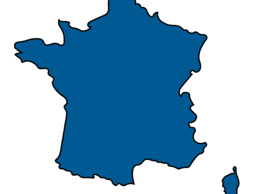
2 THE ALPS: A MAP FOR SKI AND TRAIN LOVERS
Neil Guthrie is a big fan of winter sports. The high density of ski resorts is naturally also what brought the Englishman to the Alps. In 2008/2009, together with a friend, he tried to go to as many as possible of the different regions and wanting to use the dense rail network of the European countries for this, he quickly found that all the maps available were not particularly helpful.
Indeed, there were detailed railway timetables for the Alpine regions but these were generally unclear and had not been developed with the needs of the winter sports lover in mind. Necessity is famously the mother of invention and the idea of his own rail map was therefore born and in winter of 2010/2011 a map called the SkiRail Map of the Alps was published.
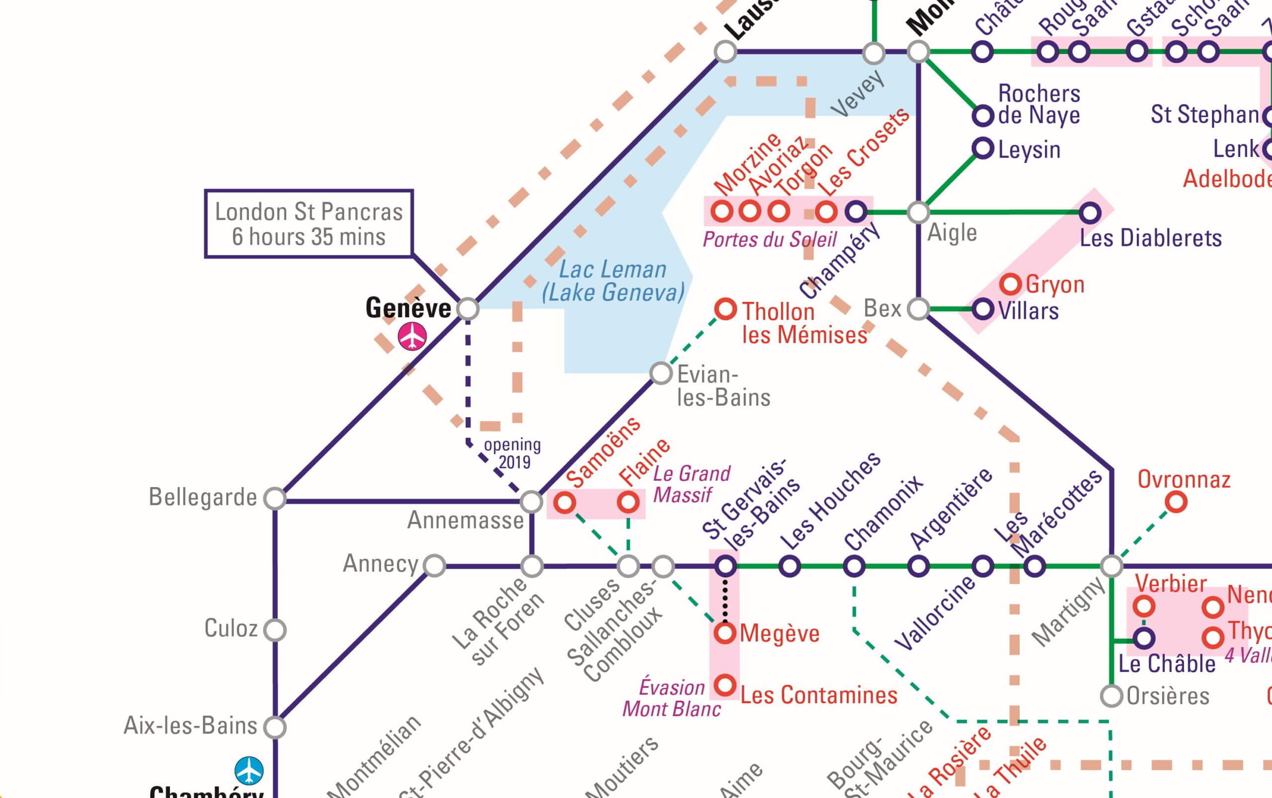
Initially, Guthrie developed a large geographical map. However, this was quite bulky to carry around and did not yet include rail connections to all resorts. The new map now offers travel information for 200 ski resorts in seven Alpine countries (Austria, Switzerland, Italy, Lichtenstein, Germany, Slovenia and France).
Direct to the piste
The experiences Guthrie gained when creating the “basic map” subsequently also fed into the development of the 2theAlps map. Together with Alan Grimade (cartographer) and Dennis Hawes (publisher), the new map was created. “Much has happened since the creation of the first map a good ten years ago.
For example, you will notice that important ski lifts in the Italian Alps have been built directly with rail connections, particularly on the Italian line from Fortezza to Lienz, e.g. at Percha station. Rather impressively, train travel in the area is also provided for free to all guests staying at local hotels.
In the Swiss Alps, by contrast, most ski resorts were already very well connected to the rail network in 2008,” the map developer reports from his observations. It took 12 months to develop the new map.
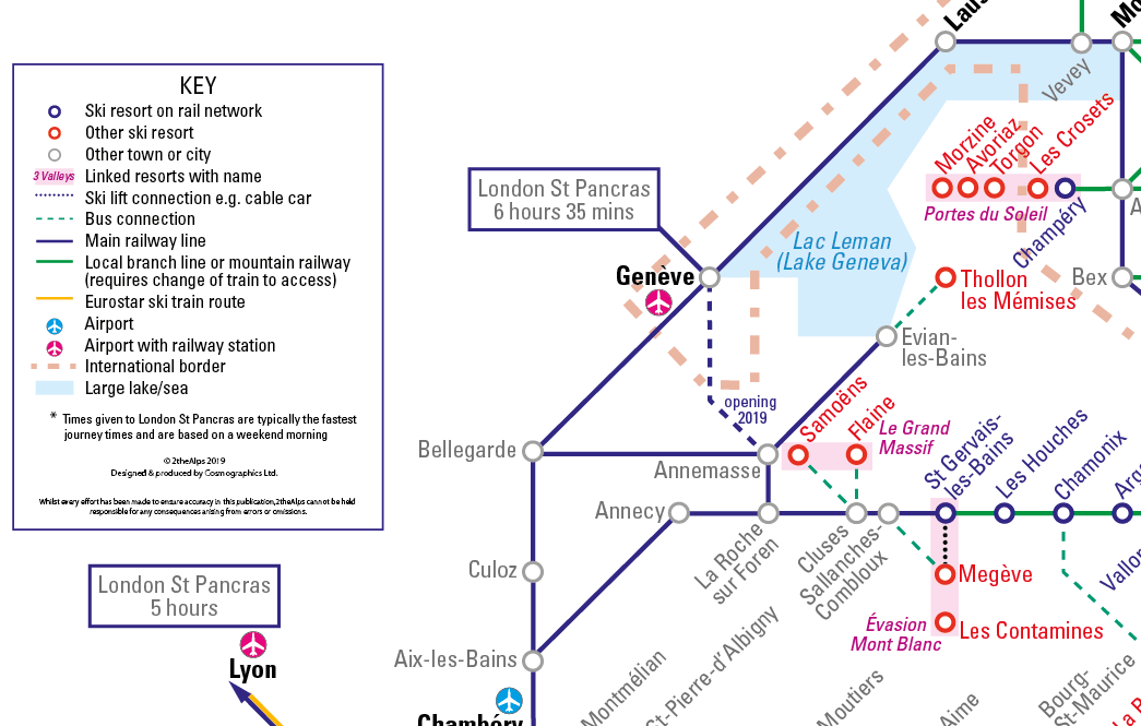
For Neil in particular, that represents many hours at the computer or on the European railways. One special thing about the map is that the times for important connections are also shown. Even on the map, you can therefore see how long it takes to get to the ski resort by train from the airport or main railway station.
If there is no railway to get to a resort secondary connections such as buses have also been marked, if these are required to cover the final metres. (e.g. you see that travel to Söll means taking the train to Wörgl and then 30 minutes by bus).
One small distinguishing feature of 2theAlps is that it is a painted map. Visually, it has been inspired by underground railway maps, which are clear and internationally intelligible. “With this map, it is important to me to raise awareness of green travel.
Particularly over short distances, buses and trains are often good alternatives and if guests are really coming from distant countries to ski in the Alps, they
will surely be happy to use the train if it is easy for them to find their way,” Neil recounts his motives for remaking the map.
International interest
Guests in the Alps come from all over the world and this is also reflected in the success of 2theAlps. Interest in the Alpine rail map is transnational and this is also motivating the developer to expand the range further.
“At the moment, the map is available only in English and from next winter in Polish but we are already working on other versions and hope that people’s interest in skiing and rail travel will remain strong,” Neil reports on the future plans.
The good news is that although the ski season this year has been a little shorter in almost all countries worldwide, the map can be used equally well for travel to mountain holidays.
Nonetheless, a new rail map for another mountain range is not yet planned, as a place would first have to be found with conditions similar to those of the Alps: with many ski resorts and a dense rail network. tm
Neil Guthrie
Developer „2 the alps“
Neil Guthrie works in the area of green transport and is a big fan of all types of maps. He is working on a cycle map of London and supports sustainability, which should not be sacrificed, especially when travelling.
With the Alpine-wide 2theAlps rail map, he wanted to inspire people to give greater consideration to sustainable travel options. It should demonstrate that trains “work” and can be a part of stress-free holiday travel.